- Australia ▾
- Topographic
▾
- Australia AUSTopo 250k (2024)
- Australia 50k Geoscience maps
- Australia 100k Geoscience maps
- Australia 250k Geoscience maps
- Australia 1.1m Geoscience maps
- New Zealand 50k maps
- New Zealand 250k maps
- New South Wales 25k maps
- New South Wales 50k maps
- New South Wales 100k maps
- Queensland 10k maps
- Queensland 25k maps
- Queensland 50k maps
- Queensland 100k maps
- Compasses
- Software
- GPS Systems
- Orienteering
- International ▾
- Wall Maps
▾
- World
- Australia & New Zealand
- Countries, Continents & Regions
- Historical
- Vintage National Geographic
- Australian Capital Territory
- New South Wales
- Northern Territory
- Queensland
- South Australia
- Tasmania
- Victoria
- Western Australia
- Celestial
- Children's
- Mining & Resources
- Wine Maps
- Healthcare
- Postcode Maps
- Electoral Maps
- Nautical ▾
- Flags
▾
- Australian Flag Sets & Banners
- Flag Bunting
- Handwavers
- Australian National Flags
- Aboriginal Flags
- Torres Strait Islander Flags
- International Flags
- Flagpoles & Accessories
- Australian Capital Territory Flags
- New South Wales Flags
- Northern Territory Flags
- Queensland Flags
- South Australia Flags
- Tasmania Flags
- Victoria Flags
- Western Australia Flags
- Gifts ▾
- Globes ▾
Dear valued customer. Please note that our checkout is not supported by old browsers. Please use a recent browser to access all checkout capabilities
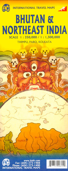
Bhutan & North East India ITMB Map
$24.95
Afterpay is only available for orders between $50.00 and $1000.00 More info

1:350,000/1:1,300,000 5th edition
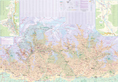
Bhutan is a lovely country but limits the number of visitors allowed to enter the country each year. Their reasoning seems to be that they only want high-end tourists who are willing to spend a minimum of $250 per day for the privilege of seeing the country. Regardless, it is an interesting country, and popular enough that monetary constraints notwithstanding, is fully booked. As with past versions of our map, one side is dedicated to Bhutan itself, with inset maps of the Thimpu area (the capital) and the Paro area further to the west.
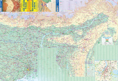
The map is in considerable detail. The other side of the map sheet is equally useful, in that it covers that portion of India from Kolkata north to Sikkim and east to the actual border with China (not the fake border shown on maps printed in China, which show all of northern India as being part of China). This is an important part of India, but not one well-travelled. Framed by the great Brahmaputra River, one can explore exotic Assam and Nagaland, or follow the Burmese border to Imphal and little-visited Aizawl.
We can laminate this map, which will allow you to draw on it in whiteboard marker or apply map dots to locations of interest without permanently marking the map. The lamination also makes the map very durable and protects against tears and stains.
To laminate this map we have taken the folded map and flattened it out before encapsulating it in high-quality 80-micron laminate, so please be aware that there will still be slight fold lines visible.
Size 680 x 990mm


