- Australia ▾
- Topographic
▾
- Australia AUSTopo 250k (2024)
- Australia 50k Geoscience maps
- Australia 100k Geoscience maps
- Australia 250k Geoscience maps
- Australia 1.1m Geoscience maps
- New Zealand 50k maps
- New Zealand 250k maps
- New South Wales 25k maps
- New South Wales 50k maps
- New South Wales 100k maps
- Queensland 10k maps
- Queensland 25k maps
- Queensland 50k maps
- Queensland 100k maps
- Compasses
- Software
- GPS Systems
- Orienteering
- International ▾
- Wall Maps
▾
- World
- Australia & New Zealand
- Countries, Continents & Regions
- Historical
- Vintage National Geographic
- Australian Capital Territory
- New South Wales
- Northern Territory
- Queensland
- South Australia
- Tasmania
- Victoria
- Western Australia
- Celestial
- Children's
- Mining & Resources
- Wine Maps
- Healthcare
- Postcode Maps
- Electoral Maps
- Nautical ▾
- Flags
▾
- Australian Flag Sets & Banners
- Flag Bunting
- Handwavers
- Australian National Flags
- Aboriginal Flags
- Torres Strait Islander Flags
- International Flags
- Flagpoles & Accessories
- Australian Capital Territory Flags
- New South Wales Flags
- Northern Territory Flags
- Queensland Flags
- South Australia Flags
- Tasmania Flags
- Victoria Flags
- Western Australia Flags
- Gifts ▾
- Globes ▾
Dear valued customer. Please note that our checkout is not supported by old browsers. Please use a recent browser to access all checkout capabilities


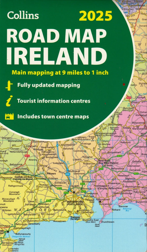
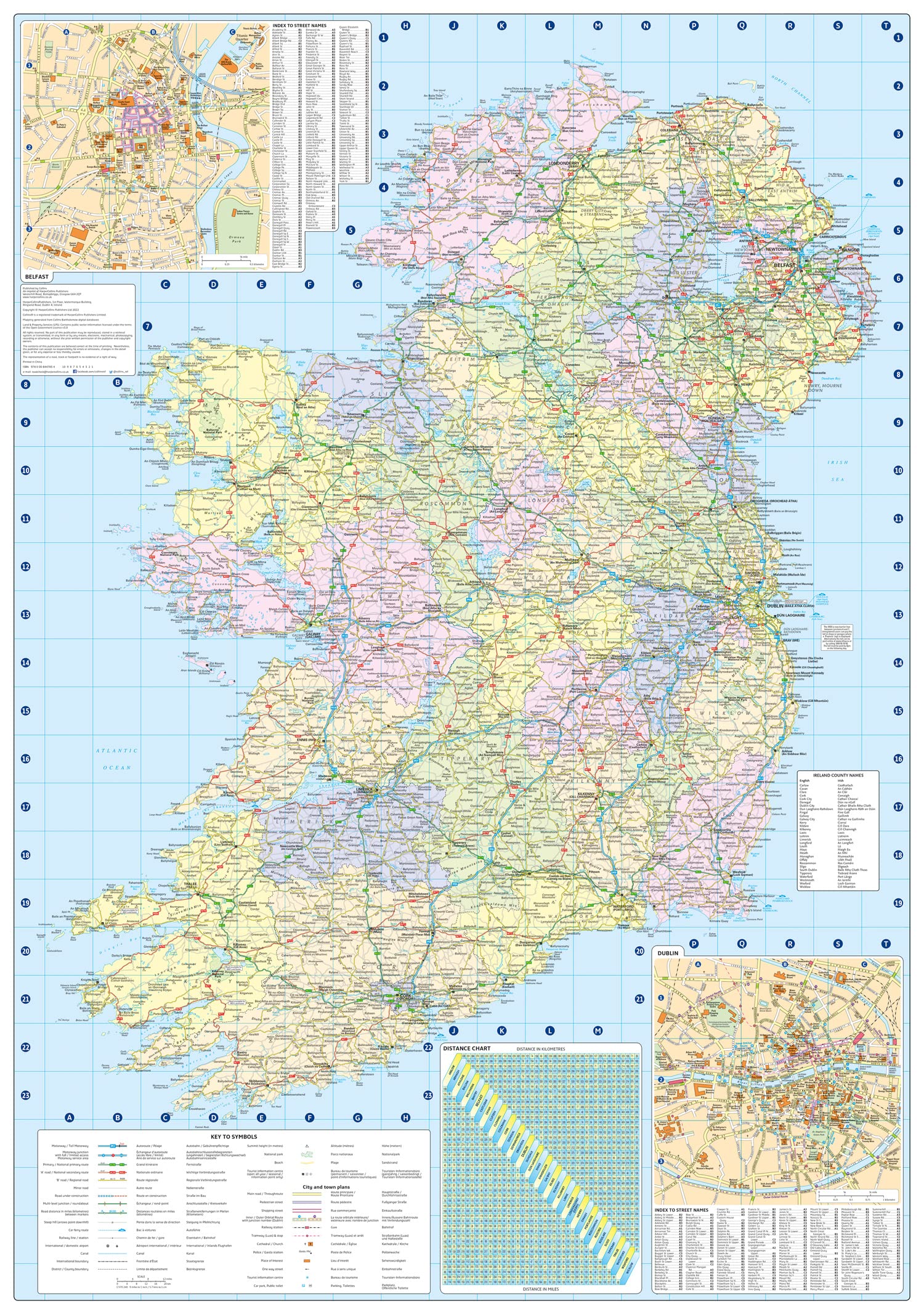
Ireland Collins Folded Map 2025
Sold Out
Afterpay is only available for orders between $50.00 and $1000.00 More info
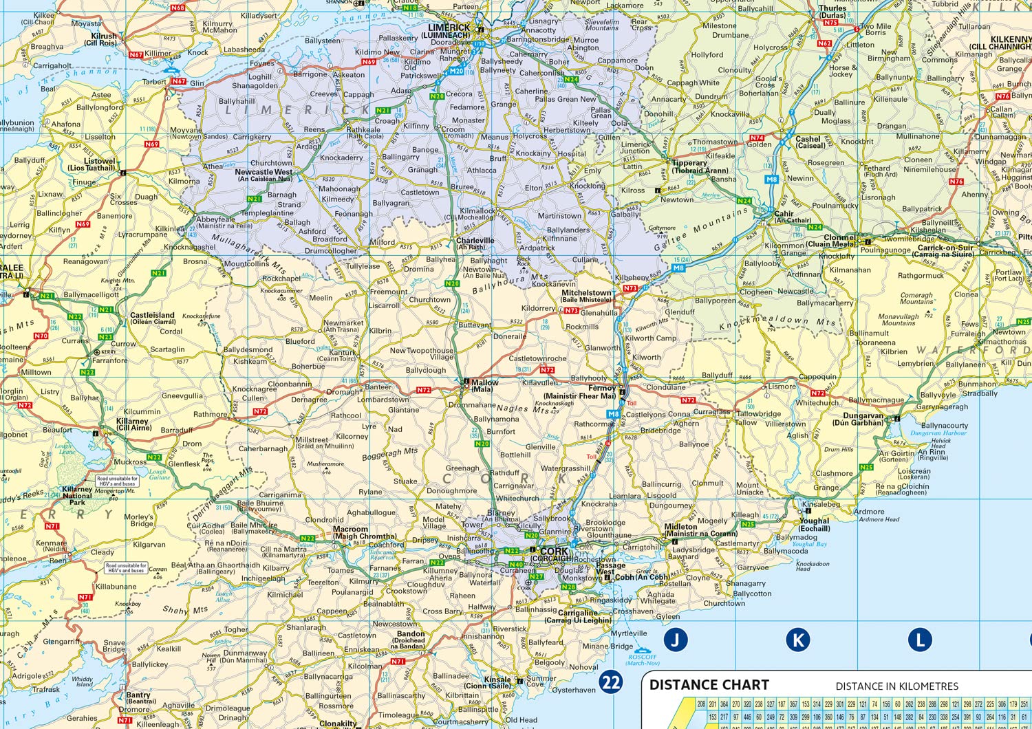
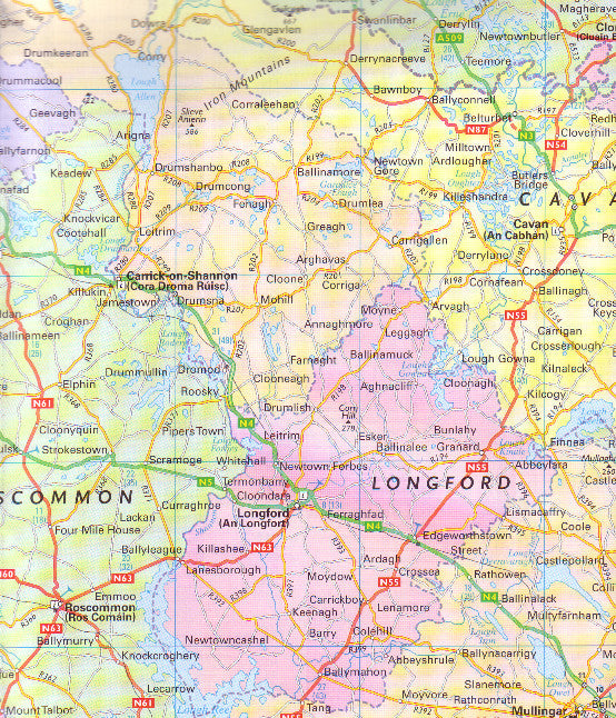
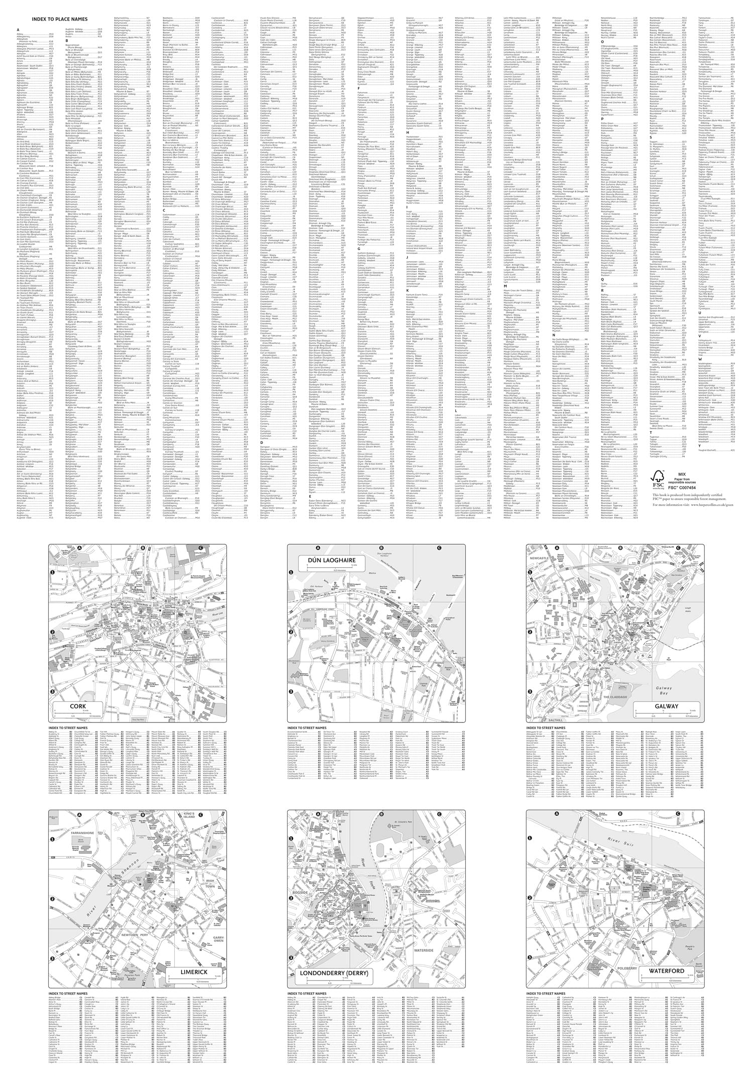
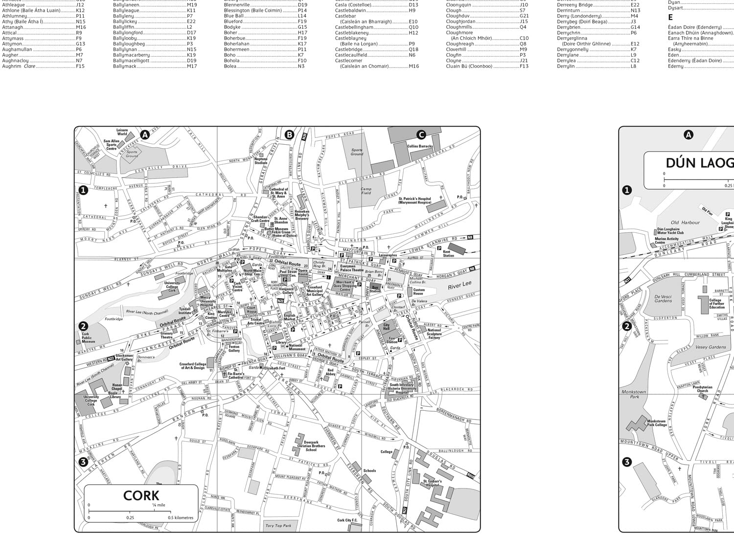
Full colour map of Ireland at 9 miles to 1 inch (1:570,240), with clear, detailed road network.
The only map of Ireland we have which shows the counties in different colours.
This map covers the whole of Ireland, and is ideal for reference or route planning.
Main features
• Fully updated
• New administrative areas shown in colour
• Clear, detailed road network
• Town and city names, rivers, lakes, spot heights, railway lines and canals are clearly shown
• City/town centre street plans of Belfast, Cork, Dublin, Dún Laoghaire, Galway, Limerick Londonderry/Derry and Waterford showing places of interest
• Full index to place names
• Mileage chart
• Car ferry routes
• Key in English, French and German
Size 1000mm x 900mm
SHIPS FROM AUSTRALIA, NEXT DAY SHIPPING


