- Australia ▾
- Topographic
▾
- Australia AUSTopo 250k (2024)
- Australia 50k Geoscience maps
- Australia 100k Geoscience maps
- Australia 250k Geoscience maps
- Australia 1.1m Geoscience maps
- New Zealand 50k maps
- New Zealand 250k maps
- New South Wales 25k maps
- New South Wales 50k maps
- New South Wales 100k maps
- Queensland 10k maps
- Queensland 25k maps
- Queensland 50k maps
- Queensland 100k maps
- Compasses
- Software
- GPS Systems
- Orienteering
- International ▾
- Wall Maps
▾
- World
- Australia & New Zealand
- Countries, Continents & Regions
- Historical
- Vintage National Geographic
- Australian Capital Territory
- New South Wales
- Northern Territory
- Queensland
- South Australia
- Tasmania
- Victoria
- Western Australia
- Celestial
- Children's
- Mining & Resources
- Wine Maps
- Healthcare
- Postcode Maps
- Electoral Maps
- Nautical ▾
- Flags
▾
- Australian Flag Sets & Banners
- Flag Bunting
- Handwavers
- Australian National Flags
- Aboriginal Flags
- Torres Strait Islander Flags
- International Flags
- Flagpoles & Accessories
- Australian Capital Territory Flags
- New South Wales Flags
- Northern Territory Flags
- Queensland Flags
- South Australia Flags
- Tasmania Flags
- Victoria Flags
- Western Australia Flags
- Gifts ▾
- Globes ▾
Dear valued customer. Please note that our checkout is not supported by old browsers. Please use a recent browser to access all checkout capabilities
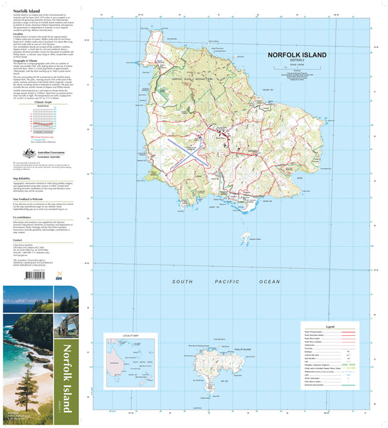
Norfolk Island Geoscience Map
$19.95
Afterpay is only available for orders between $50.00 and $1000.00 More info
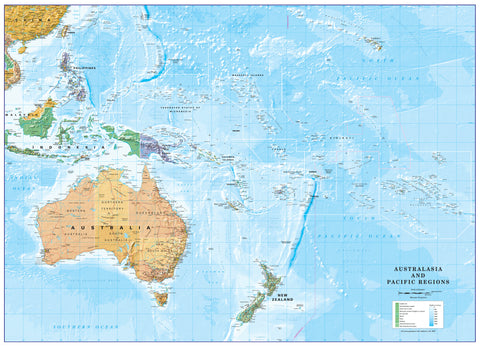
Norfolk Island is situated 1676 kilometres northeast of Sydney, at 167°57'E, 29°02'S. The Territory of Norfolk Island comprises Norfolk, Phillip and Nepean Islands, with an overall area of just over 37 square kilometres. Most of the island is a plateau formed from horizontal sheets of basalt. The highest point rises to 319 metres above sea level at Mount Bates. The island is a mountain top remnant of an elongated shield volcano. The shelf around Norfolk and surrounding islands is 95 kilometres long, north to south, and 35 kilometres wide, east to west.
Captain James Cook first landed on the island in 1788, and within the following 26 years, 40 per cent of the island's natural vegetation was cleared. Today, only five per cent of the native forest remains undisturbed. The Norfolk pine, which has become the island's icon, may reach heights of more than 60 metres, sometimes with a girth of 11 metres.
A large proportion of the natural vegetation on Phillip Island was lost when rabbits were introduced, with the island ending up as a virtual desert. However, soon after trapping the rabbits started and the last was caught in 1986, regeneration of the native vegetation began. The regrowth is now occurring rapidly.
If you would like to use this map in the field, we can supply it on waterproof/tearproof DuPont™ Tyvek®. Tyvek® is made of pure polyethylene fibres (plastic) but has the properties of paper, which means it is foldable.
We can also laminate this map, allowing you to draw on it in whiteboard marker or apply our map dots to locations of interest without permanently marking the map. The lamination also makes the map durable and protects against tears and stains.
Size: 700 mm (w) x 1000 mm (h)
Scale: 1:25,000


