- Australia ▾
- Topographic
▾
- Australia AUSTopo 250k (2024)
- Australia 50k Geoscience maps
- Australia 100k Geoscience maps
- Australia 250k Geoscience maps
- Australia 1.1m Geoscience maps
- New Zealand 50k maps
- New Zealand 250k maps
- New South Wales 25k maps
- New South Wales 50k maps
- New South Wales 100k maps
- Queensland 10k maps
- Queensland 25k maps
- Queensland 50k maps
- Queensland 100k maps
- Compasses
- Software
- GPS Systems
- Orienteering
- International ▾
- Wall Maps
▾
- World
- Australia & New Zealand
- Countries, Continents & Regions
- Historical
- Vintage National Geographic
- Australian Capital Territory
- New South Wales
- Northern Territory
- Queensland
- South Australia
- Tasmania
- Victoria
- Western Australia
- Celestial
- Children's
- Mining & Resources
- Wine Maps
- Healthcare
- Postcode Maps
- Electoral Maps
- Nautical ▾
- Flags
▾
- Australian Flag Sets & Banners
- Flag Bunting
- Handwavers
- Australian National Flags
- Aboriginal Flags
- Torres Strait Islander Flags
- International Flags
- Flagpoles & Accessories
- Australian Capital Territory Flags
- New South Wales Flags
- Northern Territory Flags
- Queensland Flags
- South Australia Flags
- Tasmania Flags
- Victoria Flags
- Western Australia Flags
- Gifts ▾
- Globes ▾
Dear valued customer. Please note that our checkout is not supported by old browsers. Please use a recent browser to access all checkout capabilities
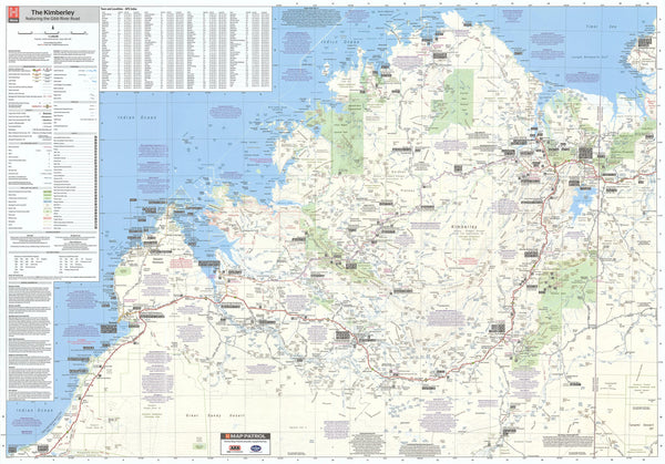
Kimberley Hema 1430 x 1000mm Supermap Laminated Wall Map with Hang Rails
$399.95
or make 4 interest-free payments of
$99.99 AUD
fortnightly with
![]() More info
More info
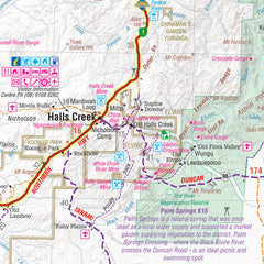
This regional map of the Kimberley places particular focus on the iconic Gibb River Road. Thoroughly field-checked using Hema's GPS Mapping System, The Kimberley map clearly differentiates between roads and tracks and shows all road distances, points of interest, and facilities.
This map comes laminated, making it very durable and versatile, so you can draw on it and wipe it off afterwards, you can also place our Mark-It-Dots to show places of interest.
The easiest way to hang your map is by having wooden hang rollers attached top and bottom with a hang cord on the top roller, so all you have to do is put a hook in the wall. The hang rails come lacquered in a natural timber colour.
This fantastic map features:
- Waterproof paper
- Detailed 4WD tracks
- National parks
- Camping areas
- GPS surveyed roads & tracks
- GPS positions and grid
Format: Laminated Wall Map with Hang Rails
Size: 1430mm (height) x 1000mm (width)
Note: Please allow 10 working days for delivery as hang rails need to be attached by our framer.


