- Australia ▾
- Topographic
▾
- Australia AUSTopo 250k (2024)
- Australia 50k Geoscience maps
- Australia 100k Geoscience maps
- Australia 250k Geoscience maps
- Australia 1.1m Geoscience maps
- New Zealand 50k maps
- New Zealand 250k maps
- New South Wales 25k maps
- New South Wales 50k maps
- New South Wales 100k maps
- Queensland 10k maps
- Queensland 25k maps
- Queensland 50k maps
- Queensland 100k maps
- Compasses
- Software
- GPS Systems
- Orienteering
- International ▾
- Wall Maps
▾
- World
- Australia & New Zealand
- Countries, Continents & Regions
- Historical
- Vintage National Geographic
- Australian Capital Territory
- New South Wales
- Northern Territory
- Queensland
- South Australia
- Tasmania
- Victoria
- Western Australia
- Celestial
- Children's
- Mining & Resources
- Wine Maps
- Healthcare
- Postcode Maps
- Electoral Maps
- Nautical ▾
- Flags
▾
- Australian Flag Sets & Banners
- Flag Bunting
- Handwavers
- Australian National Flags
- Aboriginal Flags
- Torres Strait Islander Flags
- International Flags
- Flagpoles & Accessories
- Australian Capital Territory Flags
- New South Wales Flags
- Northern Territory Flags
- Queensland Flags
- South Australia Flags
- Tasmania Flags
- Victoria Flags
- Western Australia Flags
- Gifts ▾
- Globes ▾
Dear valued customer. Please note that our checkout is not supported by old browsers. Please use a recent browser to access all checkout capabilities
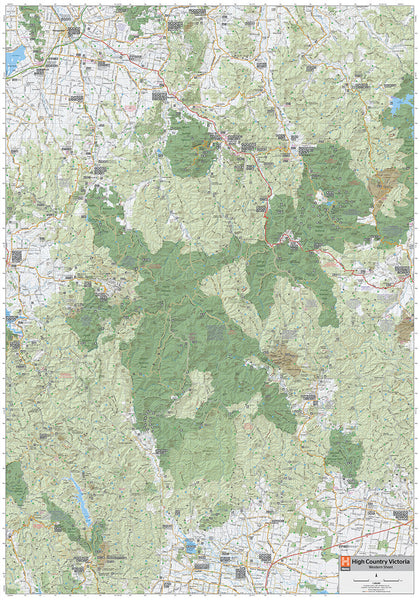
High Country Victoria Hema Map 695 x 995mm Laminated Wall Map
$49.95
Afterpay is only available for orders between $50.00 and $1000.00 More info
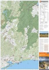
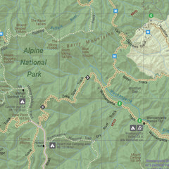
The High Country Victoria map available now with digital cartography also contains GPS surveyed roads and 4WD tracks. Coverage has been expanded to include Wangaratta and Jindabyne in the north as well as Bairnsdale and Orbost to the south. At a scale of 1:200 000 the new High Country map has great 4WD track detail.
The simple highlight system makes it easy to identify tracks that are closed seasonally. This map offers detailed road and track distances as well as facility information, including fuel supplies. There's also a handy list of contact numbers for further information.
This map is printed on waterproof/tearproof paper.
This map features:
- 4WD tracks
- Huts
- Camping areas
- Old townsites
- Seasonal track closures
- GPS grid
- Road Distances
- Hiking trails
- Accommodation
This map comes laminated allowing you to draw on it in whiteboard marker or apply map dots to locations of interest without permanently marking the map. The lamination also makes the map very durable and protects against tears and stains.
To laminate this map we have taken the folded map and flattened it out before encapsulating it in high-quality 80-micron laminate, so please be aware that there will still be slight fold lines visible.
Scale: 1:200,000
Size: 695 mm (w) x 995 mm (h)


