- Australia ▾
- Topographic
▾
- Australia AUSTopo 250k (2024)
- Australia 50k Geoscience maps
- Australia 100k Geoscience maps
- Australia 250k Geoscience maps
- Australia 1.1m Geoscience maps
- New Zealand 50k maps
- New Zealand 250k maps
- New South Wales 25k maps
- New South Wales 50k maps
- New South Wales 100k maps
- Queensland 10k maps
- Queensland 25k maps
- Queensland 50k maps
- Queensland 100k maps
- Compasses
- Software
- GPS Systems
- Orienteering
- International ▾
- Wall Maps
▾
- World
- Australia & New Zealand
- Countries, Continents & Regions
- Historical
- Vintage National Geographic
- Australian Capital Territory
- New South Wales
- Northern Territory
- Queensland
- South Australia
- Tasmania
- Victoria
- Western Australia
- Celestial
- Children's
- Mining & Resources
- Wine Maps
- Healthcare
- Postcode Maps
- Electoral Maps
- Nautical ▾
- Flags
▾
- Australian Flag Sets & Banners
- Flag Bunting
- Handwavers
- Australian National Flags
- Aboriginal Flags
- Torres Strait Islander Flags
- International Flags
- Flagpoles & Accessories
- Australian Capital Territory Flags
- New South Wales Flags
- Northern Territory Flags
- Queensland Flags
- South Australia Flags
- Tasmania Flags
- Victoria Flags
- Western Australia Flags
- Gifts ▾
- Globes ▾
Dear valued customer. Please note that our checkout is not supported by old browsers. Please use a recent browser to access all checkout capabilities
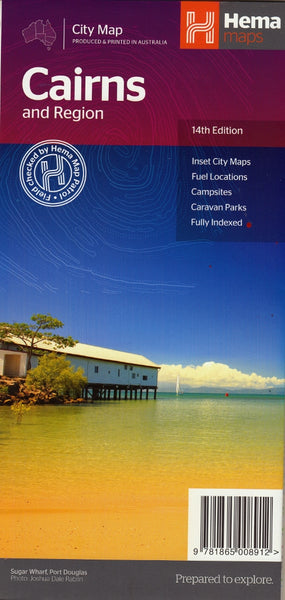
Cairns and Region Hema Map 14th Edition
$11.95
Afterpay is only available for orders between $50.00 and $1000.00 More info
The Cairns and Region map by Hema is a detailed street level road map of the city of Cairns, which also includes a regional map.
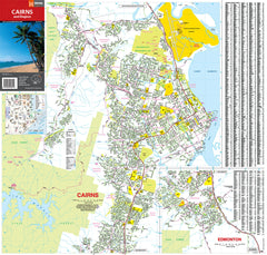
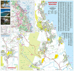
This is a double sided map, on one side is a street level map of Cairns and Edmonton with an inset map of the CBD and on the reverse is a detailed street map of the Northern Beaches and Gordonvale as well as an inset map of the surrounding region.
The street level mapping covers from Palm Cove in the Northern Beaches through Cairns Harbour down to Edmonton and Gordonvale in the south, extending out to Cascade Glen in the east.
The map comes with a comprehensive street index for easy location finding and the map shows:
- Major Highways
- Main Roads
- Minor Roads
- Railways
- Camping areas
- Rest areas with Overnight Camping
- Roadside Rest Areas (with toilet)
- Caravan Parks
- 24hr Fuel locations
- Tourist information centers
The regional maps covers from Mossman down to Wongaling Beach and east as far as Dimbulah.
Hema has also included some very nice pictures of the region to give you a flavor of what you will see on your visit.
This map is also available as a laminated map encapsulated in high quality plastic.
Scale: 1:22,500
Size: 730 mm (w) x 700 mm (h)


