- Australia ▾
- Topographic
▾
- Australia AUSTopo 250k (2024)
- Australia 50k Geoscience maps
- Australia 100k Geoscience maps
- Australia 250k Geoscience maps
- Australia 1.1m Geoscience maps
- New Zealand 50k maps
- New Zealand 250k maps
- New South Wales 25k maps
- New South Wales 50k maps
- New South Wales 100k maps
- Queensland 10k maps
- Queensland 25k maps
- Queensland 50k maps
- Queensland 100k maps
- Compasses
- Software
- GPS Systems
- Orienteering
- International ▾
- Wall Maps
▾
- World
- Australia & New Zealand
- Countries, Continents & Regions
- Historical
- Vintage National Geographic
- Australian Capital Territory
- New South Wales
- Northern Territory
- Queensland
- South Australia
- Tasmania
- Victoria
- Western Australia
- Celestial
- Children's
- Mining & Resources
- Wine Maps
- Healthcare
- Postcode Maps
- Electoral Maps
- Nautical ▾
- Flags
▾
- Australian Flag Sets & Banners
- Flag Bunting
- Handwavers
- Australian National Flags
- Aboriginal Flags
- Torres Strait Islander Flags
- International Flags
- Flagpoles & Accessories
- Australian Capital Territory Flags
- New South Wales Flags
- Northern Territory Flags
- Queensland Flags
- South Australia Flags
- Tasmania Flags
- Victoria Flags
- Western Australia Flags
- Gifts ▾
- Globes ▾
Dear valued customer. Please note that our checkout is not supported by old browsers. Please use a recent browser to access all checkout capabilities
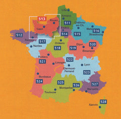
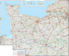
France Normandy 513 Michelin Map
Sold Out
Afterpay is only available for orders between $50.00 and $1000.00 More info
Place names on a Michelin map are in the local language as seen on the road signs.
There is only 1 map of each country irrespective of the language on the cover.
There is a key in English as well as other languages.
The mapping is produced by one of Europe's most reputable cartographers, the road detail is comprehensive.
MICHELIN Normandy Regional Map scale 1:200,000 will provide you with an extensive coverage of primary, secondary and scenic routes for this French region. In addition to Michelin's clear and accurate mapping, this regional map includes all the practical information for a trouble free journey, including major town plans as well as tourism information to make the most of your journey.
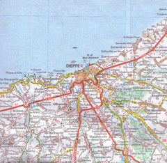
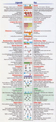
The map key identifies these mapping features:
- Motorways, including those under construction International, national and regional roads
- Road numbers
- International boundaries
- Distances in kilometres
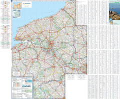
Included is an index of principal place names as well as distance and driving time charts.
Scale: 1:200,000
Size: 1200 mm x 1000 mm


