- Australia ▾
- Topographic
▾
- Australia AUSTopo 250k (2024)
- Australia 50k Geoscience maps
- Australia 100k Geoscience maps
- Australia 250k Geoscience maps
- Australia 1.1m Geoscience maps
- New Zealand 50k maps
- New Zealand 250k maps
- New South Wales 25k maps
- New South Wales 50k maps
- New South Wales 100k maps
- Queensland 10k maps
- Queensland 25k maps
- Queensland 50k maps
- Queensland 100k maps
- Compasses
- Software
- GPS Systems
- Orienteering
- International ▾
- Wall Maps
▾
- World
- Australia & New Zealand
- Countries, Continents & Regions
- Historical
- Vintage National Geographic
- Australian Capital Territory
- New South Wales
- Northern Territory
- Queensland
- South Australia
- Tasmania
- Victoria
- Western Australia
- Celestial
- Children's
- Mining & Resources
- Wine Maps
- Healthcare
- Postcode Maps
- Electoral Maps
- Nautical ▾
- Flags
▾
- Australian Flag Sets & Banners
- Flag Bunting
- Handwavers
- Australian National Flags
- Aboriginal Flags
- Torres Strait Islander Flags
- International Flags
- Flagpoles & Accessories
- Australian Capital Territory Flags
- New South Wales Flags
- Northern Territory Flags
- Queensland Flags
- South Australia Flags
- Tasmania Flags
- Victoria Flags
- Western Australia Flags
- Gifts ▾
- Globes ▾
Dear valued customer. Please note that our checkout is not supported by old browsers. Please use a recent browser to access all checkout capabilities
Perth UBD 662 Map 1380 x 2000mm Laminated Wall Map
$549.00
or make 4 interest-free payments of
$137.25 AUD
fortnightly with
![]() More info
More info
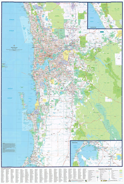
This huge laminated map of Perth by UBD is great for the office
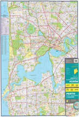
What makes this map unique is that it either covers at street level detail a 10km radius of central Perth, covering from Trigg in the northwest to Noranda in the northeast, down to North Coogee in the southwest over to Victoria Park in the southeast.
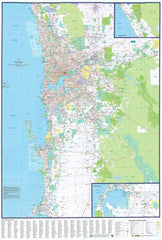
Or the map shows a 75km radius of Perth's suburbs with arterial routes and main roads marked from Quinns Rocks in the north down to Mandurah in the south; the map also includes a detailed inset of Pinjarra. It also shows general suburban built-up areas, national parks and industrial areas. Each suburb name is marked complete with postcodes and listed in a corresponding index.
The high-quality laminate in which the map is encapsulated allows you to draw on it with a whiteboard marker or apply map dots to locations of interest without permanently marking it. The lamination makes the map very durable and protects against tears and stains.
IMPORTANT: As this is a print on demand map, it is only possible to have one side showing; please use the drop-down menu to choose either the 75km radius side or the 10km radius side.
Format: Flat / Laminated
Size: 1380 mm (w) x 2000 mm (h)
Please allow ten working days for delivery.


